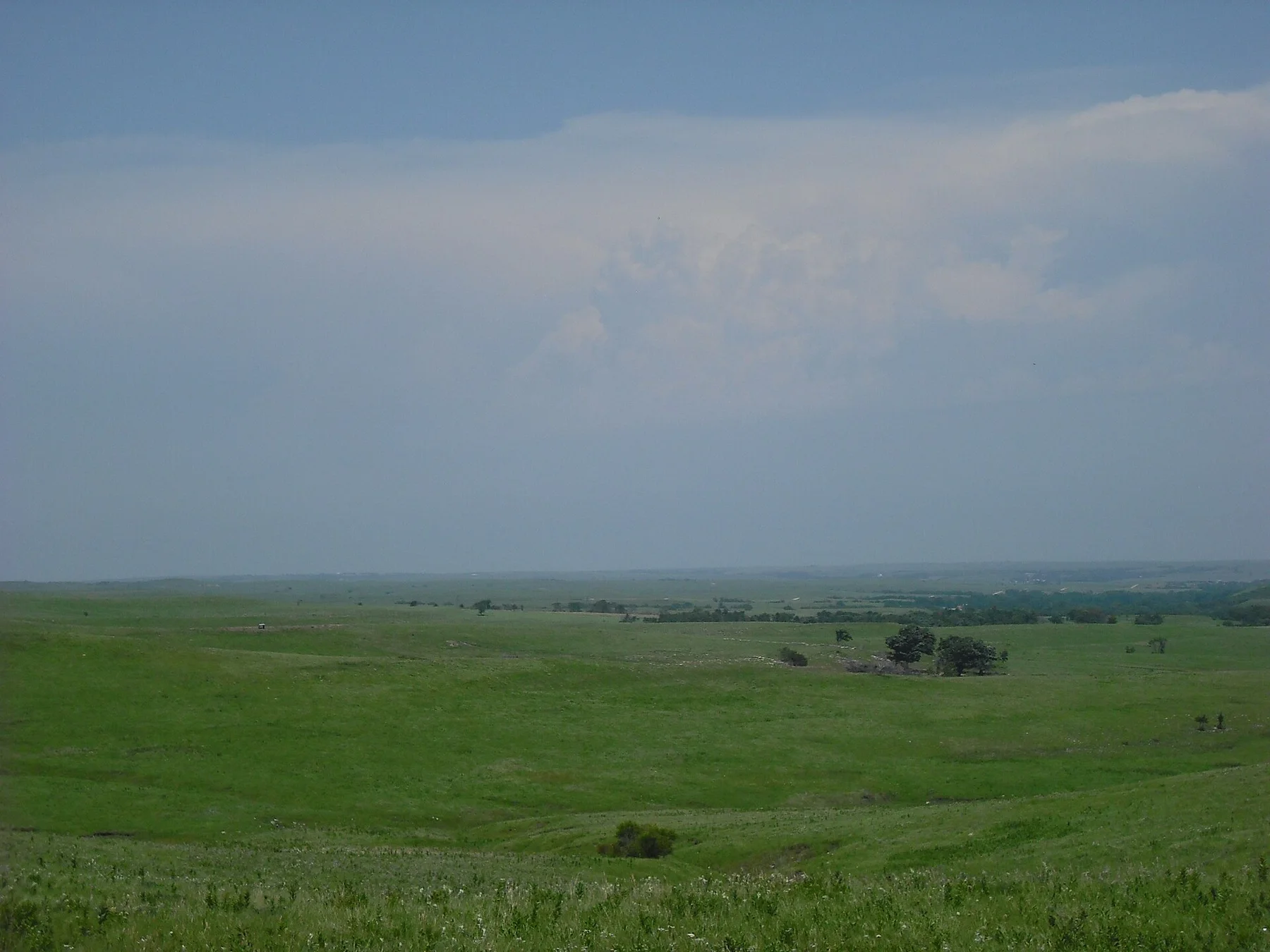
Walk into the prairie until the visitor centre disappears
The experience depends on distance from the road: grass, wind and bison tracks gradually replace every built reference.
Use sunrise or the final two hours of light, when relief, wildlife and grass colour become much easier to read.
Look a little closer
Worth discovering
The details that make Tallgrass Prairie Preserve different.
Destination view
01
Bison loop trails
Hiking routes cross open range used by the herd.
Photo journal
02
Spring Hill Ranch
Stone buildings explain the region's ranching history.
Photo journal
03
Flint Hills ridges
Shallow rocky soils protected the prairie from ploughing.
Photo journal
A closer look at Tallgrass Prairie Preserve
7 photographs
01Smoke lingers on prescribed burn days. (d979ad98-cef8-49ba-87a3-fc0cd1cdb69d)02Sunset falls across the beautiful Flint Hills (f0f6c731-1dd8-b71b-0b88-d326127c9973)03Tallgrass Prairie Preserve — view 304Flint Hills Scenic Byway - Entrance to Tallgrass Prairie National Preserve - NARA - 771838905Flint Hills P530038306Flint Hills P530039507Greenery and road, Saint Anthony Cemetery, Chase County, Kansas
Beyond the surface
Reading the layers of Tallgrass Prairie Preserve
One of the largest remaining tallgrass landscapes preserves rolling hills, bison and historic ranch buildings. This account follows the forces, communities and decisions that made the present landscape.
4 min readFlint Hills, Kansas, United States
Tallgrass Prairie Preserve is centred on Flint Hills, Kansas, where one of the largest remaining tallgrass landscapes preserves rolling hills, bison and historic ranch buildings. The strongest reason to make the journey is to walk into the prairie until the visitor centre disappears.
The strongest visual shorthand for Tallgrass Prairie Preserve is the experience described as “Walk into the prairie until the visitor centre disappears”. Behind it lies a more complex relationship between physical processes, settlement and the modern idea of the place as a destination. The experience depends on distance from the road: grass, wind and bison tracks gradually replace every built reference.
Flint Hills Scenic Byway - Entrance to Tallgrass Prairie National Preserve - NARA - 7718389See the complete photo journal
01
Origins
How the landscape was assembled
Before roads, settlements or protected-area boundaries, the terrain of Tallgrass Prairie Preserve set the basic terms. The terrain is subtle rather than flat: long ridges, coulees, dunes and river breaks become visible with low light and slow travel. Wildlife often provides the main sense of scale.
Altitude turns distance into effort and creates abrupt ecological boundaries. At Tallgrass Prairie Preserve, “Bison loop trails” provides a useful reference point for understanding that vertical structure. Hiking routes cross open range used by the herd.
02
Human history
Routes, livelihoods and belonging
The Flint Hills escaped widespread ploughing because shallow, stony soils made crop farming difficult. Kanza and Osage peoples used a grassland maintained by fire and bison, while nineteenth-century removal opened the region to settler ranching.
Large cattle operations used seasonal burning to produce fresh spring grass, and limestone ranch buildings remain part of the landscape. The national preserve was created in 1996 around the former Spring Hill or Z Bar Ranch.
03
Reorganisation
From local landscape to protected destination
Protection did not freeze the prairie; managers continue prescribed burning and grazing, including bison, because tallgrass diversity depends on disturbance. The preserve is therefore both a historic ranch and an actively managed ecosystem.
04
Visible evidence
Where the story becomes visible
At Tallgrass Prairie Preserve, the feature “Bison loop trails” is best understood as part of the surrounding system rather than an isolated stop. Hiking routes cross open range used by the herd. At Tallgrass Prairie Preserve, it gives a concrete reference point for reading change rather than merely collecting viewpoints.
Start with the feature “Spring Hill Ranch”, because it condenses a much larger part of the story of Tallgrass Prairie Preserve. Stone buildings explain the region's ranching history. Within Tallgrass Prairie Preserve, it is both an attraction and a record of the processes described above.
Start with the feature “Flint Hills ridges”, because it condenses a much larger part of the story of Tallgrass Prairie Preserve. Shallow rocky soils protected the prairie from ploughing. Within Tallgrass Prairie Preserve, it is both an attraction and a record of the processes described above.
05
Season and scale
The current chapter
At Tallgrass Prairie Preserve, season is part of the landscape history, not merely a planning detail. For Tallgrass Prairie Preserve, the most reliable visiting window is Apr-Oct.
For Tallgrass Prairie Preserve, the stated visiting window is Apr-Oct, but its practical meaning depends on local weather, water and transport rather than the calendar alone.
Placed within its wider geography, Tallgrass Prairie Preserve is not an isolated exception. Beyond the best-known image of Tallgrass Prairie Preserve feature, Tallgrass Prairie Preserve matters because spring hill ranch and flint hills ridges place the destination inside a broader regional story.
Chronology
Key dates
Kanza and Osage grasslands
Fire, bison and Indigenous movement shaped the tallgrass mosaic.
Ranching replaces open bison range
Stone fences, cattle and rail connections reorganised the Flint Hills.
National preserve established
A working ranch landscape became the centre of tallgrass conservation.
Travel notes
Plan your visit
Time needed
2-3 days
Getting around
Car, scenic roads and walking trails
Effort
Easy to moderate
Plan first
Accommodation, fuel and wildlife conditions
Time of day
Sunrise and the final hours of light
Best window
Apr-Oct
Traveller stories
Stories from people who have been here.
First-hand moments, practical notes and overlooked details from Tallgrass Prairie Preserve.