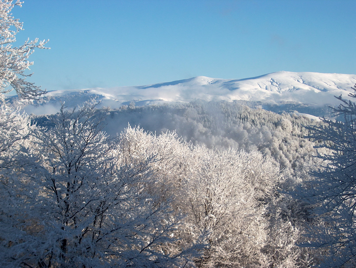
High country above the Radika

Mavrovo

A western Balkan landscape of high mountains, deep forest, pastoral villages and a reservoir that has become part of the region's visual identity.

MountainsVillagesLakes

Location
Western North Macedonia, North Macedonia
Best window
May-Oct
Suggested stay
3-5 days
Go for
Balkan mountain circuit
The reason to go

A complete mountain region rather than one summit

Mavrovo brings together the Korab massif, the Radika valley, traditional villages and high meadows, allowing a trip to move between hiking, architecture and everyday mountain life.

Stay long enough to connect Mavrovo's headline landscape with one quieter local route rather than treating it as a single viewpoint.

Look a little closer

Worth discovering

The details that make Mavrovo different.

Photo journal
01

A church in changing water

The old church of Saint Nicholas can stand partly surrounded by reservoir water, its appearance shifting with water level.

Destination view
02

Reka villages

Stone houses, woodwork and village layouts preserve distinctive local building traditions in the wider Reka region.

Destination view
03

Korab scale

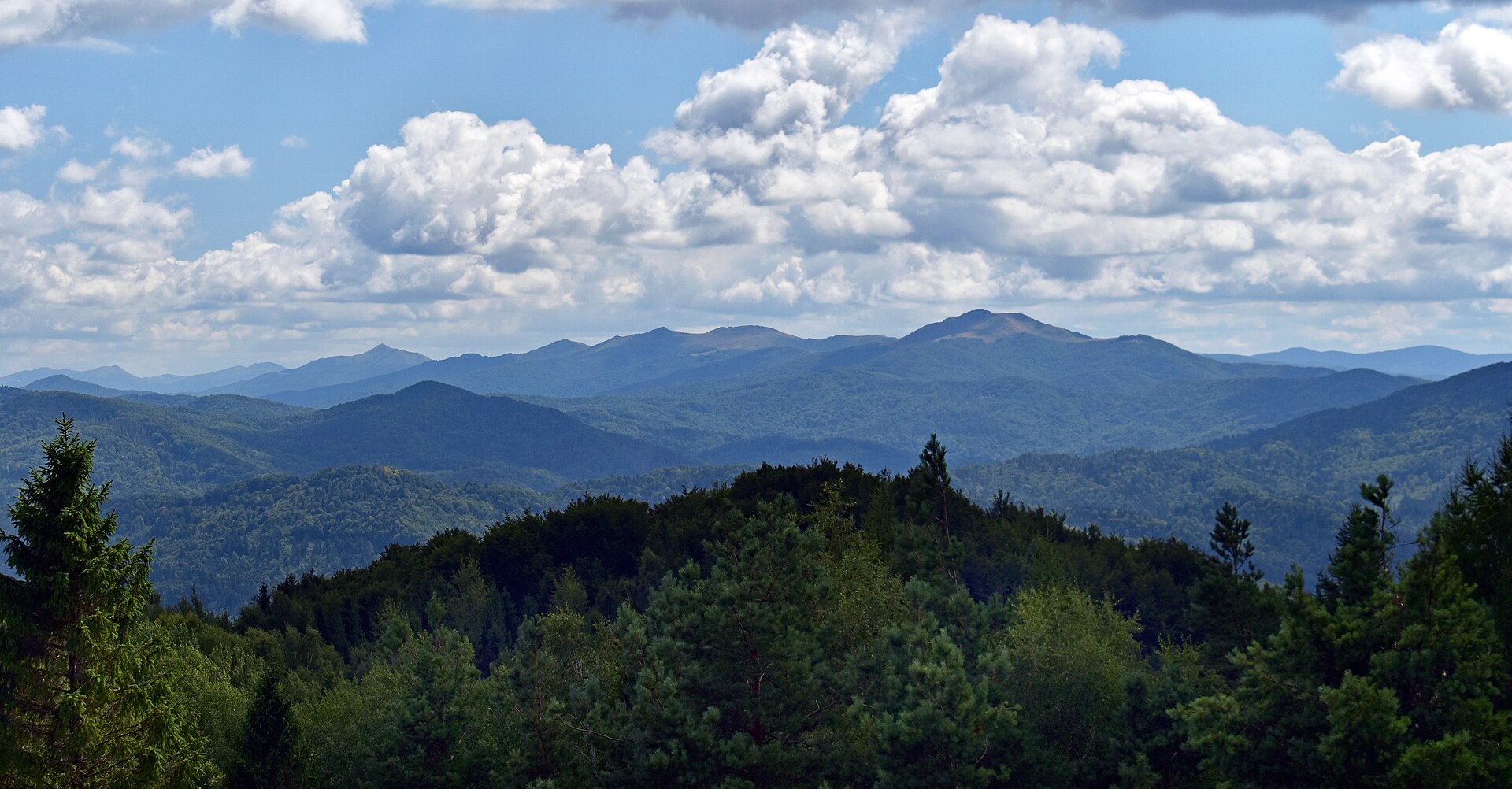
The national park reaches the country's highest mountain terrain and feels much larger than the resort zone around the lake.

Photo journal

A closer look at Mavrovo

4 photographs
Beyond the surface

What made Mavrovo distinctive

A western Balkan landscape of high mountains, deep forest, pastoral villages and a reservoir that has become part of the region's visual identity. The deeper story links its visible features with the people and changes behind them.

Mavrovo brings together the Korab massif, the Radika valley, traditional villages and high meadows, allowing a trip to move between hiking, architecture and everyday mountain life.

The strongest visual shorthand for Mavrovo is the experience described as “Balkan mountain circuit”. Behind it lies a more complex relationship between physical processes, settlement and the modern idea of the place as a destination. At Mavrovo, allow enough time to connect Mavrovo's headline landscape with one quieter local route instead of reducing Mavrovo to a single viewpoint.

Continue to practical planning
Bike trip in northern MacedoniaSee the complete photo journal
Natural history

How the landscape was assembled

Before roads, settlements or protected-area boundaries, the terrain of Mavrovo set the basic terms. Sharp limestone and metamorphic peaks rise above forested valleys, karst features, river gorges and open summer pastures used by livestock and wildlife.

The skyline is only the upper edge of a larger system. At Mavrovo, “A church in changing water” connects the high ground with valleys, settlement and the movement of water below. The old church of Saint Nicholas can stand partly surrounded by reservoir water, its appearance shifting with water level.

Lives and livelihoods

The human landscape behind the scenery

The Mavrovo basin and Radika valley have long been a mountain borderland of Orthodox Christian and Muslim villages, seasonal livestock routes and skilled building traditions. Monasteries, mosques, stone houses and pasture paths record communities connected toward Debar, Gostivar and the high Korab country.

Mavrovo National Park was created in 1949. Hydroelectric development soon dammed the Mavrovska River and created Lake Mavrovo, inundating low ground around the old Church of Saint Nicholas; its partially submerged walls became the clearest symbol of the engineered landscape.

Change

The modern turning point

The reservoir, ski centre and roads shifted the area from dispersed pastoral economy toward energy production and tourism. Debates over additional hydropower and habitat protection show that the park remains a working and contested landscape rather than a static reserve.

Details to read

What to read in the landscape

At Mavrovo, the feature “A church in changing water” is best understood as part of the surrounding system rather than an isolated stop. The old church of Saint Nicholas can stand partly surrounded by reservoir water, its appearance shifting with water level. Its position and condition at Mavrovo connect physical history with the way people use the place now.

Look closely at the feature “Reka villages” in Mavrovo; it carries information that a panoramic view can miss. Stone houses, woodwork and village layouts preserve distinctive local building traditions in the wider Reka region. Within Mavrovo, the feature explains why this destination differs from nearby landscapes.

At Mavrovo, the feature “Korab scale” is best understood as part of the surrounding system rather than an isolated stop. The national park reaches the country's highest mountain terrain and feels much larger than the resort zone around the lake. Within Mavrovo, the feature explains why this destination differs from nearby landscapes.

Continuity

What continues to change

At Mavrovo, season is part of the landscape history, not merely a planning detail. Late spring fills valleys with water and flowers, summer opens the high routes, and early autumn is calmer. Snow creates a separate winter destination around the resort area.

For Mavrovo, the most useful time of day is: morning in the high valleys.

For Mavrovo, plan this first: trail conditions and mountain base.

Placed within its wider geography, Mavrovo is not an isolated exception. For Mavrovo, the wider context shows that, debar, the Korab approaches and the monasteries and villages of the Radika valley make the region work best as a road-and-walking circuit.

Chronology

Key dates

  1. Mountain villages and seasonal pasture

    Religious, farming and herding communities organised life along the Radika and high summer routes.

  2. Mavrovo National Park established

    Protection covered forests, villages and high mountains in western Macedonia.

  3. Reservoir and hydropower system

    Damming created the lake and transformed transport, settlement edges and the local economy.

In context

Get to know the place

The landscape

Sharp limestone and metamorphic peaks rise above forested valleys, karst features, river gorges and open summer pastures used by livestock and wildlife.

People and place

Macedonian, Albanian and Mijak cultural histories meet in villages known for masonry, woodcarving, pastoral work and seasonal movement between valley and mountain.

Seasonal character

Late spring fills valleys with water and flowers, summer opens the high routes, and early autumn is calmer. Snow creates a separate winter destination around the resort area.

Beyond the main view

Debar, the Korab approaches and the monasteries and villages of the Radika valley make the region work best as a road-and-walking circuit.

Travel notes

Plan your visit

Time needed
3-5 days
Getting around
Car, local taxi and hiking
Effort
Easy to challenging
Plan first
Trail conditions and mountain base
Time of day
Morning in the high valleys
Best window
May-Oct
Keep exploring

Where next?

All place stories