Upland between savannas

Loita Hills

Forest, high grassland and Maasai communities occupy a quieter upland between the Rift Valley and the Mara plains.

Sacred forestMaasai communitiesHigh grassland

Location
Great Rift Valley, Kenya
Best window
Jun-Oct, Jan-Feb
Suggested stay
2-4 days
Go for
Forest and cultural highlands
The reason to go

Forest of the Lost Child

Dense forest, streams and local stories create the most enclosed and culturally significant part of the hills.

Build the visit around sunrise or late afternoon. Low light reveals relief, animal movement and surface colour that disappear around midday.

Look a little closer

Worth discovering

The details that make Loita Hills different.

Destination view
01

Forest of the Lost Child

Dense forest, streams and local stories create the most enclosed and culturally significant part of the hills.

Destination view
02

Rift-edge viewpoints

Open ridges reveal the relationship between upland forest and the lower savanna landscapes.

Destination view
03

Community-led routes

Local guides connect ecological detail with land use, ceremony and the contemporary life of the hills.

Photo journal

A closer look at Loita Hills

1 photograph
Landscape and history

The landscape memory of Loita Hills

Forest, high grassland and Maasai communities occupy a quieter upland between the Rift Valley and the Mara plains. The view is only the surface of a longer story of formation, use and change.

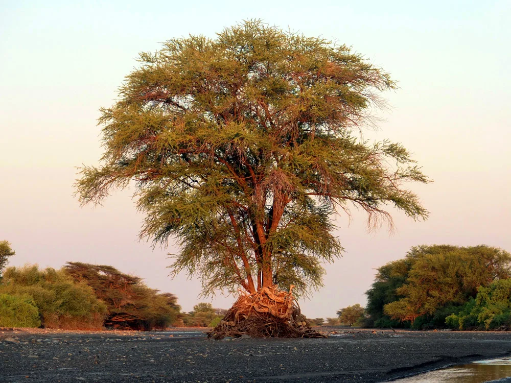
The Loita Hills rise east of the Maasai Mara as a broad upland of forest, grassland and deeply cut valleys. Unlike the open plains below, the hills are enclosed and green, with springs and streams feeding surrounding dry country. The Forest of the Lost Child is one of the most distinctive sections.

The familiar invitation at Loita Hills is “Forest of the Lost Child”, yet that image makes more sense when it is connected to the landform, the local economy and the changes that determined access. Dense forest, streams and local stories create the most enclosed and culturally significant part of the hills.

Continue to practical planning
Maasai dancer in Loita Hills, KenyaSee the complete photo journal
Physical setting

The forces behind the first impression

Understanding Loita Hills starts below the visible surface. Dense indigenous forest alternates with open ridges and grazing areas. Paths rather than roads connect many parts of the landscape, and mist can settle over higher ground. Views from the edges extend across the Rift Valley and Mara ecosystem.

Dense vegetation hides long views, so detail becomes the guide. At Loita Hills, “Forest of the Lost Child” offers a way to read water, soil and disturbance inside the forest system. Dense forest, streams and local stories create the most enclosed and culturally significant part of the hills.

Lives and livelihoods

Settlement, movement and local knowledge

At Loita Hills, people learned to work with the landscape limits rather than arriving after its story was complete. The hills are closely tied to Maasai community use, ceremony, grazing and local governance. Travel should be locally guided and based on consent rather than treating the forest as an empty reserve. This cultural relationship is central to why the landscape remains intact.

At Loita Hills, the feature described as “Rift-edge viewpoints” offers a second line of evidence. Open ridges reveal the relationship between upland forest and the lower savanna landscapes. Within Loita Hills, it shows how local knowledge and practical use became embedded in the landscape.

Modern history

How access and attention changed the place

Formal protection changed how Loita Hills was described and managed. At Loita Hills, new boundaries, visitor rules and conservation priorities created a public identity that still has to coexist with settlements, customary use and economic pressures. Loita Hills should therefore be read as an evolving cultural landscape rather than a timeless scene.

Field notes

Landmarks that carry the deeper story

At Loita Hills, the feature “Forest of the Lost Child” provides a precise clue to how the landscape works. Dense forest, streams and local stories create the most enclosed and culturally significant part of the hills. For Loita Hills, that relationship is more informative than treating the feature only as a photograph or checklist item.

At Loita Hills, the significance of the feature “Rift-edge viewpoints” goes beyond its visual impact. Open ridges reveal the relationship between upland forest and the lower savanna landscapes. At Loita Hills, it gives a concrete reference point for reading change rather than merely collecting viewpoints.

At Loita Hills, the feature “Community-led routes” is best understood as part of the surrounding system rather than an isolated stop. Local guides connect ecological detail with land use, ceremony and the contemporary life of the hills. At Loita Hills, it gives a concrete reference point for reading change rather than merely collecting viewpoints.

Present day

Season, scale and the present day

At Loita Hills, season is part of the landscape history, not merely a planning detail. Drier seasons make walking and road approaches easier. Rain brings strong vegetation and flowing streams but can make tracks difficult. Nights are cooler than on the surrounding plains because of elevation.

For Loita Hills, the main seasonal constraint is: the strongest planning window is Jun-Oct, Jan-Feb. For Loita Hills, outside it, check weather, daylight, road or ferry schedules and seasonal closures before committing to a fixed route.

For Loita Hills, one practical detail matters: cloud, wind and trail conditions can change quickly. For Loita Hills, put the highest or most exposed stop first and keep a lower-level alternative.

Placed within its wider geography, Loita Hills is not an isolated exception. For Loita Hills, the wider context shows that, loita sits between several famous safari regions but has a different scale and purpose. For Loita Hills, its value is the continuity of community-managed forest and highland rather than concentrations of vehicles or lodges.
Travel notes

Plan your visit

Time needed
2-4 days
Getting around
Car to access points, then walking or hiking
Effort
Moderate
Plan first
Opening days and any limited-entry sites
Time of day
Start early for clearer conditions and more time
Best window
Jun-Oct, Jan-Feb
Traveller stories

Stories from people who have been here.

First-hand moments, practical notes and overlooked details from Loita Hills.

Loading traveller stories…

Browse all traveller stories ↗

Keep exploring

Where next?

All place stories