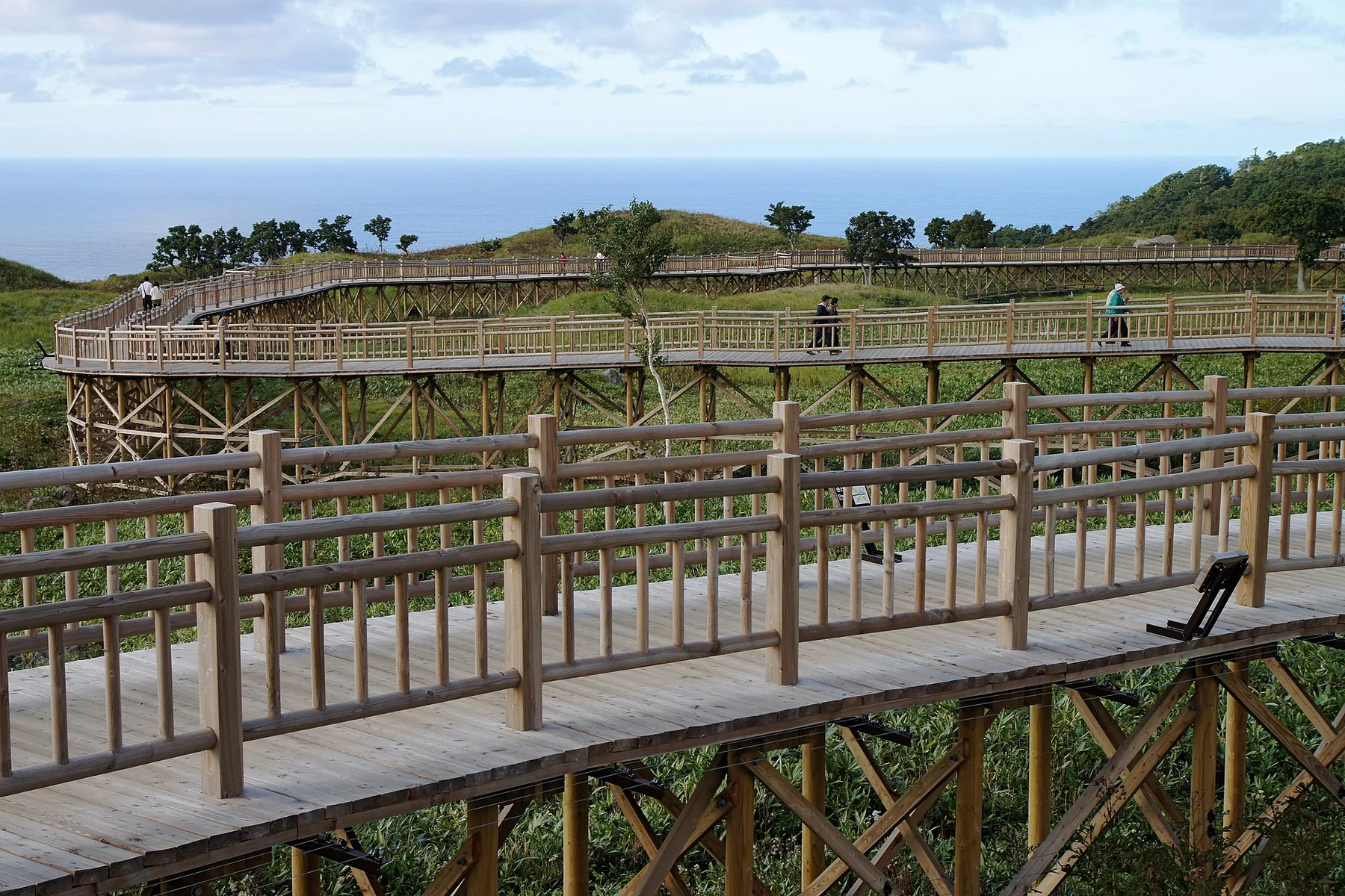
Philippine Sea island

Lanyu

A volcanic island east of Taiwan where dramatic coastal rock, tropical slopes and Tao communities create a distinct maritime cultural landscape.

Volcanic coastTao cultureTropical island

Location
Philippine Sea, Taiwan
Best window
Mar-Jun, Oct-Nov
Suggested stay
3-5 days
Go for
Maritime island circuit
The reason to go

Tao villages

Settlement patterns, boats and community life express an island culture rooted in the surrounding sea.

Plan the least frequent boat, ferry or exposed coastal section first. Use early or late light and keep a weather alternative during Mar-Jun, Oct-Nov.

Look a little closer

Worth discovering

The details that make Lanyu different.

Photo journal
01

Tao villages

Settlement patterns, boats and community life express an island culture rooted in the surrounding sea.

Photo journal
02

Coastal rock forms

Volcanic headlands and isolated formations give each section of the ring road a different profile.

Destination view
03

Mountain interior

Steep tropical slopes rise immediately behind the coast and keep the island's centre comparatively inaccessible.

Photo journal

A closer look at Lanyu

11 photographs
Deep background

How Lanyu became the place it is

A volcanic island east of Taiwan where dramatic coastal rock, tropical slopes and Tao communities create a distinct maritime cultural landscape. Its character becomes clearer when geology, settlement and modern protection are considered together.

Lanyu, also known as Orchid Island, lies southeast of Taiwan in the Philippine Sea. A mountainous volcanic interior descends toward a ring road, small bays and coastal villages. The island is the homeland of the Tao people, whose seafaring traditions and settlement forms make Lanyu culturally distinct from Taiwan's main island.

Many visits to Lanyu begin with the experience described as “Tao villages”. The more revealing question is why it exists here, how people used the surrounding ground and what remains visible from earlier phases. Settlement patterns, boats and community life express an island culture rooted in the surrounding sea.

Continue to practical planning
Traditional Tao Building Inside in Orchid Island 2010-9-15See the complete photo journal
Physical setting

Why the terrain has this form

At Lanyu, the form of the landscape explains many of the choices that came later. Dark volcanic rock, coral-fringed water and steep green slopes dominate the coast. Isolated rock formations rise from headlands and offshore water, while the interior remains rugged and heavily vegetated. The circular road repeatedly shifts between exposed ocean views and compact village sections.

Because land is limited, every ridge, bay and passage acquires practical importance. At Lanyu, “Tao villages” is where that compressed geography becomes easiest to read. Settlement patterns, boats and community life express an island culture rooted in the surrounding sea.

Human history

People, work and memory

At Lanyu, people learned to work with the landscape limits rather than arriving after its story was complete. Tao communities maintain strong relationships with fishing, boat building and seasonal flying-fish traditions. Traditional semi-subterranean houses survive alongside newer construction, and village spaces are active rather than staged. Visitors need to approach local customs, sacred areas and photography with care.

At Lanyu, “Coastal rock forms” should not be treated as a decorative detail. Volcanic headlands and isolated formations give each section of the ring road a different profile. The feature records how construction, movement or livelihood adapted to local conditions at Lanyu.

Reorganisation

What altered the old balance

The decisive modern change at Lanyu was access. At Lanyu, transport and visitor infrastructure made the landscape easier to reach while concentrating pressure at the few points where roads, boats or trails enter it. Lanyu should therefore be read as an evolving cultural landscape rather than a timeless scene.

Visible evidence

Landmarks that carry the deeper story

At Lanyu, the feature “Tao villages” is best understood as part of the surrounding system rather than an isolated stop. Settlement patterns, boats and community life express an island culture rooted in the surrounding sea. Within Lanyu, the feature explains why this destination differs from nearby landscapes.

At Lanyu, the feature “Coastal rock forms” is one of the most useful pieces of visible evidence. Volcanic headlands and isolated formations give each section of the ring road a different profile. For Lanyu, that relationship is more informative than treating the feature only as a photograph or checklist item.

At Lanyu, the feature “Mountain interior” is one of the most useful pieces of visible evidence. Steep tropical slopes rise immediately behind the coast and keep the island's centre comparatively inaccessible. Its position and condition at Lanyu connect physical history with the way people use the place now.

Living landscape

The current chapter

Lanyu changes through the year because weather and biological cycles rearrange what can be seen and used. Spring and early summer coincide with important fishing traditions and generally warm conditions. Typhoon risk and heavy rain affect late summer and early autumn. October and November can offer a quieter period, though flights and ferries remain sensitive to sea and wind conditions throughout the year.

For Lanyu, the main seasonal constraint is: the strongest planning window is Mar-Jun, Oct-Nov. For Lanyu, outside it, check weather, daylight, road or ferry schedules and seasonal closures before committing to a fixed route.

For Lanyu, one practical detail matters: cloud, wind and trail conditions can change quickly. For Lanyu, put the highest or most exposed stop first and keep a lower-level alternative.

Placed within its wider geography, Lanyu is not an isolated exception. Lanyu is geographically closer to the northern Philippines than much of Taiwan, and its ecology and culture reflect this maritime position. For Lanyu, the island rewards a slow circuit with time in villages and coastal landscapes rather than a rushed sequence of named rocks.

Travel notes

Plan your visit

Time needed
3-5 days
Getting around
Car to access points, then walking or hiking
Effort
Moderate
Plan first
Accommodation and seasonal transport
Time of day
Start early for clearer conditions and more time
Best window
Mar-Jun, Oct-Nov
Traveller stories

Stories from people who have been here.

First-hand moments, practical notes and overlooked details from Lanyu.

Loading traveller stories…

Browse all traveller stories ↗

Keep exploring

Where next?

All place stories